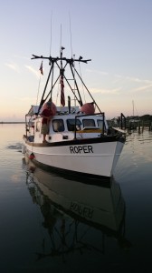
The R/V Roper, IMH’s 36’, steel-hulled, ex-shrimp trawler turned dive research vessel approaches the loading dock. She returns June 22 for another summer of research in St. Augustine.
It’s that time of year again: the higher humidity is returning to the air while temperatures rise both here on land and in the water offshore; in order to accommodate the busy summer season, the St. Augustine Lighthouse & Maritime Museum will soon be returning to extended hours; and our research arm, the St. Augustine Lighthouse Archaeological Maritime Program (LAMP), is preparing to return to the field for another season of research in the waters of our nation’s oldest port.
We have a lot to look forward to this season: the Museum’s new research center will soon be complete which will have new conservation space, education space, and office space; twelve new students will be joining us for our annual field school in underwater archaeology, beginning June 26th; and the R/V Roper, the Institute of Maritime History’s (IMH) 36’ research vessel, is returning to serve as our main dive platform for the 2017 season.
The story we aim to focus on this season is that of the Anniversary Wreck, an as yet unidentified shipwreck located within a mile of St. Augustine’s shores. Discovered during 2015’s 450th Anniversary Shipwreck Survey, the site is proving to be an exciting project with a dense artifact scatter, the nature of which currently leads archaeologists to believe it may represent a merchant vessel, although the exact time period of the wreck and nationality of the vessel are still unknown.

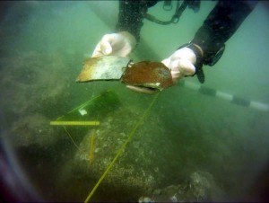
Here a diver holds recently excavated stoneware sherds from the Anniversary Wreck. The sherds help narrow the time frame of the wreck to sometime between 1750 and 1820.

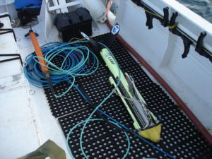
The marine magnetometer (left) and sidescan sonar (right), which are employed during remote sensing survey.
This season will also include elements of remote sensing survey, where archaeologists employ a sidescan sonar (for acoustic imaging) and a marine magnetometer (for magnetic field detection). These instruments are used to identify potential new archaeological sites for further investigation, as well as to monitor those we have already studied, in order to observe how these sites change from year to year, and to look out for potential damage from things like storms, erosion, or looting.
We have a few weeks yet before the Roper and our new students arrive, so for the time being we are finishing up the last bits of yearly equipment maintenance and organization while making sure the final pieces of preseason preparation are in order. Soon, though, we will be back to 6 a.m. starts, and days filled with digging, recording, and hopefully, no small amount of discovery into the maritime landscape of our own ancient city. We can’t wait to share with you what we find.


